Hiking the Logar Valley, Slovenia's Quiet Alpine Valley
Is the Logar Valley worth visiting for hiking in Slovenia?
Yes — Logarska dolina is a glacial valley in the Kamnik-Savinja Alps, northeast of Ljubljana and geographically separate from the Bled-Bohinj-Triglav area. It offers a gentle valley-floor walk to the Rinka waterfall as well as demanding routes to alpine huts, with far fewer visitors than Slovenia's better-known lakes.
A valley the Bled crowds never find
Most first-time visitors to Slovenia build their itinerary around a single mental map: Ljubljana, then Bled, then maybe Bohinj and a hike toward Triglav. That map is accurate for the Julian Alps and the Triglav National Park, but it leaves out an entire alpine range sitting quietly to the northeast. The Logar Valley, or Logarska dolina, belongs to the Kamnik-Savinja Alps, a separate massif with its own glacial trough, its own waterfall, and its own network of huts — and it does not show up on the same tourist maps as Bled or Bohinj, because it genuinely is not in the same part of the country.
That distinction matters more than it sounds. Travelers searching for “Slovenia mountain valley” often land on photos of the Logar Valley’s flat green floor ringed by limestone walls and assume it is somewhere near Bled. It is closer to Kamnik and Solčava, a good hour’s drive northeast of the Ljubljana basin in a different direction entirely from the road to Bled. If you have already done the classic Bled-Bohinj-Triglav circuit, or if you simply want a mountain valley without the coach parking of high summer, this is where to look next.
Where exactly is the Logar Valley
Logarska dolina is a U-shaped glacial valley roughly 7 km long, carved into the southern flank of the Kamnik-Savinja Alps near the Slovenia-Austria border area. The gateway village is Solčava, and the valley is one of three glacial troughs radiating from it — Logarska dolina, Robanov kot and Matkov kot — sometimes linked together as the Solčava Panoramic Road, a scenic loop road built specifically to let visitors see all three without retracing the same route twice.
Unlike the Triglav National Park around Bohinj, the Logar Valley sits inside a separate protected area, the Kamnik-Savinja Alps Landscape Park. That is the practical reason it never gets folded into guides about hiking around Lake Bohinj or climbing Triglav: different range, different park administration, different trailheads. If you are cross-referencing a paper map bought at Bled, do not expect to find Logarska dolina on it.
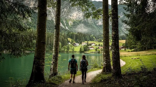
The valley’s most recognizable feature is its shape: a flat, green, farmed floor between steep rock walls, closed at its head by the Rinka waterfall dropping from a hanging valley above. It reads almost like a smaller, wilder cousin of a Dolomites valley floor, and photographers who know the spot rate the early morning light on the meadows as one of inland Slovenia’s better-kept scenes.
Getting there from Ljubljana
By car, the drive from Ljubljana to Solčava and the Logar Valley entrance covers roughly 75 to 90 minutes, heading northeast through Kamnik and up the Savinja valley on regional roads rather than motorway. Because the route runs mostly on non-motorway roads, you may not need Slovenia’s electronic vignette at all for this specific trip — but if any leg of your route touches the motorway network (for example coming from Celje or Maribor), the e-vinjeta is still required and sold only electronically. Our vignette guide covers current categories and prices before you pick up a rental.
There is no train service into the valley, and public bus connections to Solčava are thin and seasonal, which is the main reason independent travelers without a car tend to book an organized trip instead. A guided day tour solves the access problem entirely and usually adds a stop at Velika Planina or another Kamnik-Savinja Alps highlight along the way — worth comparing against a rental car if you are already reading our guide to Slovenia without a car or weighing renting a car in Slovenia against a tour for this one excursion.
The valley floor walk everyone can do
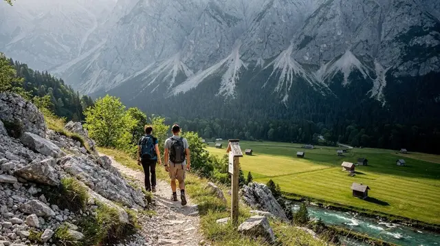
The valley’s easiest and most popular route runs from the entrance area along the flat valley floor to the base of the Rinka waterfall, a round trip of roughly 5 to 6 km on gravel paths and wooden boardwalk sections. Budget 90 minutes to two hours at an easy pace, including time to stop at the waterfall viewing platform. There is minimal elevation gain until the very last stretch, which climbs briefly to a platform facing the falls.
This walk passes working farms, grazing meadows, and small wooden huts that still function as seasonal dairy operations — a working alpine landscape rather than a manicured park. It suits almost anyone: families with young children on foot, older visitors, and hikers who simply want scenery without a mountain day. Pair it with a stop for buckwheat pastries or local dairy at one of the farms along the route, a small but genuine taste of how this valley still earns its living.
Into the highlands: harder trails
Beyond the valley floor, the Logar Valley opens onto serious mountain terrain. Trails climb toward the Okrešelj mountain hut at the head of a hanging side valley, gateway to routes up peaks including Planjava, Ojstrica and Turska gora, some of the more technical summits in the Kamnik-Savinja Alps. From Okrešelj, marked paths and via ferrata sections continue toward Kamniško sedlo, the saddle linking this side of the range to Kamnik’s own approach trails.
These are full mountain days, not extensions of the valley floor walk: expect several hours of steady climbing, exposed sections on the higher via ferrata routes, and huts that are seasonal rather than year-round. None of this requires a permit — Slovenia’s mountains generally do not gate access behind paperwork, the same as climbing Triglav itself — but a map, proper boots, and honest judgment about the weather matter far more here than at the Rinka waterfall path. Anyone drawn to the exposed, cabled sections should read our via ferrata guide for what that kind of terrain actually demands before committing to it in the Kamnik-Savinja Alps rather than around Triglav.
Robanov kot and Matkov kot: the valley’s quieter neighbors
If Logarska dolina already feels uncrowded, its two neighboring valleys along the Solčava Panoramic Road go a step further. Robanov kot, immediately east, is smaller and almost entirely undeveloped, with its own short waterfall walks and grazing farms. Matkov kot, further along, is the quietest of the three, tucked against the border area with fewer facilities and correspondingly fewer visitors.
None of the three valleys are large enough to fill more than a half day each, so a common pattern for hikers based near Kamnik or making a full day of the Kamnik-Savinja Alps is to drive the panoramic road, choosing one valley for a proper walk and treating the other two as scenic stops. This is also where the region connects loosely to Velika Planina, the shepherds’ plateau on the opposite side of Kamnik — different in character, alpine pasture rather than glacial trough, but reachable in the same day for anyone building a Green Ring itinerary out of Ljubljana.
Practical matters: toll, huts, and getting oriented
A small per-vehicle toll is collected at a staffed kiosk near the valley entrance close to Solčava, funding road upkeep and the park’s conservation work. It applies mainly during the staffed season in warmer months, and since no single official source publishes one fixed figure, treat any number you see online as an estimate and expect to pay a modest cash amount at the gate.
Mountain huts along the higher routes, including Okrešelj, serve simple food and drink in season and can offer basic overnight beds for anyone tackling the peaks above the valley over two days rather than one. Down on the valley floor, facilities are limited to the farms themselves and a small visitor information point near the entrance — there is no town inside the valley, so plan fuel, food, and cash before you arrive from Kamnik or Solčava.
When to hike the Logar Valley
The valley floor walk to the Rinka waterfall is comfortable from late spring through mid-autumn, roughly May to October, and the toll kiosk and farm stalls are generally staffed through that same window. Summer is the busiest period by local standards, though nothing close to Bled’s peak crowds. Our seasonal guides to Slovenia in summer and Slovenia in autumn both apply here, with autumn arguably the better light for photographers given the meadows’ color and thinner visitor numbers.
The higher routes toward Okrešelj and Kamniško sedlo are a different question: snow can linger into June and return by October, and conditions above the valley floor should be checked locally rather than assumed from a mild forecast down in Ljubljana. Anyone considering the valley in winter should read Slovenia in winter first — the valley floor can still be walked in snow with the right footwear, but the mountain routes move firmly into technical winter mountaineering territory, well beyond a standard hiking day.
Logar Valley versus the Bled-Bohinj-Triglav trail network
It is worth stating the distinction plainly, since it is the single most common confusion travelers bring to this valley: the Logar Valley is not a lesser-known trail inside Triglav National Park, and it will not appear alongside routes from our guides to hiking around Lake Bohinj or the Pokljuka plateau on any map built around that park. It sits in a wholly separate range, reached by a different road out of Ljubljana, administered by a different protected-area authority, and visited by a noticeably smaller crowd.
That separation is exactly its appeal for a second-time visitor. If your first Slovenia trip already covered the Bled versus Bohinj comparison and you are past debating which lake to prioritize, the Logar Valley offers a genuinely different alpine experience within the same short driving radius of the capital — proof that Slovenia’s compactness keeps paying off well past the obvious first stops.
How to book a Logar Valley hike from Ljubljana
Given the limited public transport, most visitors reach the valley either by rental car or by joining an organized excursion out of Ljubljana. For a guided option that pairs the valley with one of the region’s other Kamnik-Savinja Alps highlights, a guided hiking tour combining Velika Planina with the Logar Valley covers both in a single day without any driving on your part.
Travelers who want the valley on its own, at a more relaxed pace, can look at a straightforward day trip from Ljubljana to the Logar Valley. For a longer alpine circuit that extends toward the border area, an alpine day tour linking Logarska dolina with the Jezersko valley covers more ground for hikers who want a fuller mountain day rather than the valley floor alone.
If you are building a longer trip and want more than one alpine excursion, our guide to multi-day tours from Ljubljana and our notes on private guides and custom tours both cover how to combine a Kamnik-Savinja Alps day with the Julian Alps further west, and our broader Slovenia hiking itinerary shows where a day here fits into a full week of trails without overlapping the Bled-Bohinj-Triglav routes already on most travelers’ lists.
For families weighing options across the whole country, our best Slovenia activities for families guide places the valley floor walk alongside other easy, high-reward outings, and the hiking and mountains category rounds up every other trail-based page on the site if you want to compare regions before committing to one.
Common questions about hiking the Logar Valley
Where is the Logar Valley and how far is it from Ljubljana?
The Logar Valley, known locally as Logarska dolina, sits in the Kamnik-Savinja Alps in the northeast of Slovenia, near the village of Solčava. It is roughly 80 km from Ljubljana, about a 75 to 90 minute drive through Kamnik and the Savinja valley.
Is the Logar Valley part of Triglav National Park?
No. Triglav National Park sits further west, around Bohinj, Bovec and the Julian Alps. The Logar Valley belongs to a separate protected landscape park within the Kamnik-Savinja Alps, so it will not appear on maps built around Bled, Bohinj or the Triglav massif.
What is the easiest hike in the Logar Valley?
The valley-floor path to the Rinka waterfall is the easiest option: a flat, well-marked trail of roughly 5 to 6 km round trip on gravel and boardwalk, manageable in about 90 minutes to two hours at a relaxed pace, with only a short climb to the waterfall viewpoint itself.
Can I visit the Logar Valley without a car?
It is possible but limited — public transport into Solčava and the valley is sparse, and most independent travelers drive or join an organized day tour from Ljubljana. A guided hiking tour is the simplest way to reach the valley without renting a vehicle.
Is there an entrance fee for cars in the Logar Valley?
A small per-vehicle toll is collected at an entrance kiosk near Solčava, covering road maintenance and conservation of the valley; it applies mainly in the warmer months when the kiosk is staffed. Confirm the current amount locally, since it is not centrally published.
Can I combine the Logar Valley with Velika Planina in one day?
Yes, and it is a common pairing on organized tours: both sit in the same Kamnik-Savinja Alps corner of Slovenia, roughly an hour apart by road, so a single day trip from Ljubljana can cover the herders’ huts of Velika Planina in the morning and the valley floor or Rinka waterfall walk in the afternoon.
When is the best time to hike the Logar Valley?
Late spring through early autumn, roughly May to October, offers the most reliable trail conditions. Summer is busiest but still quiet compared with Bled; the high routes toward Okrešelj and Kamniško sedlo can hold snow into June and again from October, so check conditions before attempting anything above the valley floor outside summer.
Is the Logar Valley suitable for families with children?
The valley-floor walk to the Rinka waterfall is stroller-friendly in its lower section and easy for children on foot, with grazing meadows, a working farm or two, and the waterfall itself as a natural reward. The higher trails toward the mountain huts involve real elevation gain and are better suited to older children and confident walkers.
tours.hiking-mountains
Verified deep-linked GetYourGuide tours. Book through these links and we earn a small commission at no cost to you.
GetYourGuide does not provide a product photo for this activity — the image shows the meeting point, photographed by us.